
Our itinerary at a glance
| Day | Plan | Sleep at |
|---|---|---|
| 1 | Arrive in Kathmandu | 1,400 m |
| 2 | Drive to Chame | 2,670 m |
| 3 | Trek to Upper Pisang | 3,300 m |
| 4 | Trek to Ngawal | 3,660 m |
| 5 | Trek to Manang | 3,540 m |
| 6 | Acclimatization day in Manang | 3,540 m |
| 7 | Trek to Yak Kharka | 4,050 m |
| 8 | Trek to Thorong Phedi | 4,525 m |
| 9 | Cross Thorong La, down to Muktinath | 3,760 m |
| 10 | Visit Muktinath, drive to Marpha | 2,670 m |
| 11 | Drive to Pokhara | 820 m |
| 12 | Return to Kathmandu | 1,400 m |
| 13 | Departure | None |
Other routes begin much lower. Sources list Besisahar at about 760 to 790 m, and some companies start the walk from Dharapani, at about 1,860 m. Road access has changed where many people start.
Why heights differ between sources
You'll see different numbers everywhere. For example, Thorong Phedi is listed at about 4,450 m in one itinerary and 4,510 m in another, while we use about 4,525 m. Muktinath is often listed from about 3,760 m to 3,800 m. Maps and GPS devices differ, and villages spread across a slope. A few dozen metres doesn't change your planning, but the overall daily gain does.
The big day: Thorong La
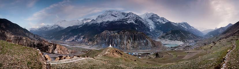
This is the crux of the trek. Sources describe climbing nearly 900 m from Thorong Phedi to the pass, and then descending more than 1,600 m to Muktinath. Our plan allows about 8 hours, but it can take longer. People usually start very early, while it's still dark and very cold.
Some itineraries sleep at High Camp, above Thorong Phedi, to make pass day shorter. That cuts the climb, but you spend the night higher. Ask your guide what suits your group, and remember that altitude affects each person differently.
How to acclimatize
The CDC says that above 3,000 m, you shouldn't increase your sleeping altitude by more than 500 m per day, and that you should take a rest day every 3 to 4 days. The easy part is walking slowly. The hard part is having the discipline to take that time, particularly if everyone around you seems fine.
- Sleep height matters most. You can walk higher during the day and come back down to sleep.
- Use the rest day. Our plan stays in Manang for a second night, with a short hike.
- Report symptoms early. A headache, nausea, tiredness or dizziness should be taken seriously.
- Never go up with worsening symptoms. Stop, tell your guide, and go down if things get worse.
- Ask about medication. Talk to a doctor before you travel about acetazolamide and whether it suits you.
Our plan's drive to Chame is a large jump, and a few later days also gain close to or above 500 m. Going slowly, or adding a day where you need it, is sensible. Read our altitude sickness guide.
The side trip to Tilicho Lake
Some people add Tilicho Lake, a very high lake reached by a side route from the Manang area. It adds extra days and altitude, so it isn't something to fit in casually. See our Tilicho Lake Trek, and talk it over with your guide.
Daily height gain on our plan
Sleeping height is what to watch. These are the biggest upward steps on our itinerary, using approximate figures.
| Stage | Sleeping height gain |
|---|---|
| Kathmandu to Chame, by road | About 1,270 m |
| Chame to Upper Pisang | About 630 m |
| Manang to Yak Kharka | About 510 m |
| Yak Kharka to Thorong Phedi | About 475 m |
Season and the pass
Snow can make the pass dangerous or close it, especially in winter. Spring and autumn are the most reliable times, but sudden snowfall can happen then too. Hire a guide who watches the conditions, and allow a spare day. See our season guide.
Fitness for the height
There's no technical climbing on the normal route in good conditions, but it's still a long, tiring day above 5,000 m. Build up to long hill walks with a pack. Fitness helps, but it doesn't stop you from getting altitude sickness, so stay honest about how you feel. Our guide to how hard Everest Base Camp is covers similar preparation.
Common questions
Is Thorong La higher than Everest Base Camp?
Yes. It's about 5,416 m, compared with Everest Base Camp at about 5,364 m. Kala Patthar, however, is higher, at about 5,545 m.
Do you sleep above 5,000 m?
Not on the normal route. People usually sleep at Thorong Phedi or High Camp, then cross the pass and descend the same day.
Can I go the other way round?
It's not recommended for most people. Going east to west means a much bigger climb in one day to reach the pass from Muktinath.
Is the road affecting the climb?
Roads reach further up the valley than they used to. If you drive high in one day, your body gets less time to adapt, so ask how your operator deals with this.
Next steps
See our Annapurna Circuit Trek, read our cost guide, or ask us about a slower plan.


Comments